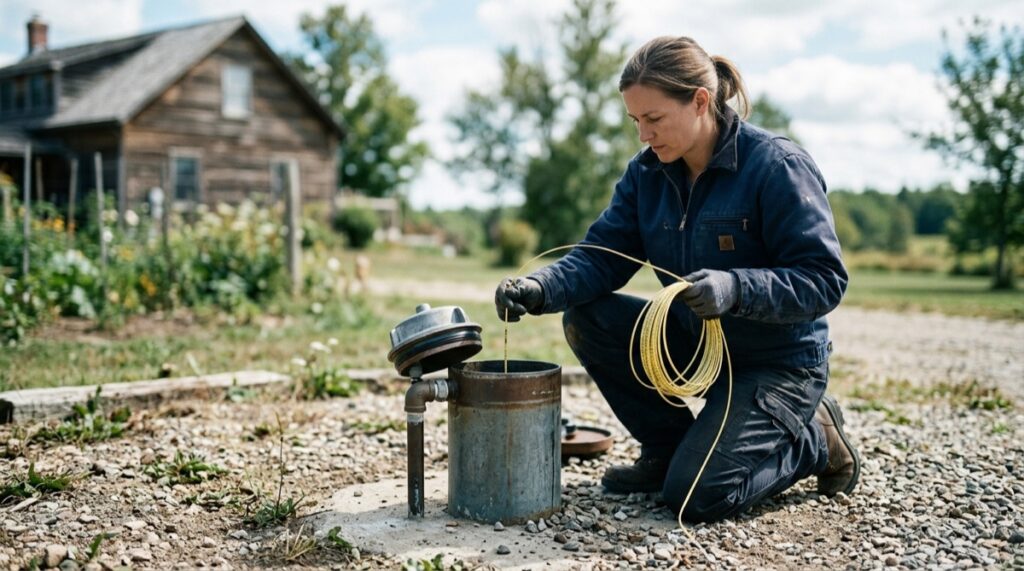
There is no universal “right” well depth. A water well must reach an aquifer that can supply usable water reliably while meeting the construction standards in your state, province, county, or municipality. An aquifer is a layer of sand, gravel, or fractured rock that can store and transmit groundwater.
Use local well records and the site assessment to discuss possible depth with a well professional. A national range does not establish what your property will need.
The water table is not the same thing as the required well depth. A driller may encounter water at 60 feet yet continue drilling to reach a more dependable producing zone, provide storage inside the well, avoid a vulnerable shallow layer, or satisfy construction rules. Conversely, the water level in a 400-foot well might rise and stand only 70 feet below the ground.
So, how deep should a well be? Deep enough to reach a dependable aquifer, accommodate seasonal water-level changes, deliver the required yield, and comply with local rules—but no deeper without a defensible reason. The driller does not choose an arbitrary depth. The geology does.
What actually determines well depth?
1. Local geology and aquifer depth
Geology is the dominant factor because groundwater behaves differently in different underground materials.
In sand and gravel, water occupies the spaces between individual grains. A well completed in this type of aquifer normally uses a screen: a slotted section that admits water while holding back most of the surrounding sediment. The driller looks for a sufficiently thick, permeable layer rather than stopping at the first trace of moisture.
Bedrock wells work differently. Solid granite, gneiss, slate, and many other rocks hold very little accessible water within the rock itself. The useful water enters through cracks and fractures. A driller can pass through 100 feet of nearly dry rock, intersect a productive fracture over the next few feet, and then encounter little additional water below it.
Limestone and dolomite can contain fractures, bedding openings, and solution channels created as water slowly dissolves the rock. These openings may carry substantial water, but their distribution can be irregular. They can also allow contaminants to travel farther and faster than homeowners expect.
The elevation and position of the lot matter as well. A property on a ridge may require a deeper well than a nearby property in a valley, even when both sit over the same named rock formation. The thickness of soil and sediment above bedrock can also change considerably over a short distance.
2. State, provincial, and local construction standards
Finding water is only part of building an acceptable well. Regulations may specify minimum well depth, casing length, grout placement, separation from septic systems, the height of the wellhead above grade, approved materials, disinfection, testing, and who may perform the work.
These rules are not uniform. Ontario, for example, generally requires a new well to be at least 6 metres deep, with an exception where the only useful aquifer requires a shallower completion. Several US states use minimum casing depths near 20 feet, but their exceptions and bedrock requirements differ. Counties and health departments may add conditions related to local geology or development permits.
For US work, confirm that the contractor holds the required license. In Canada, confirm the required licence or registration under the province’s rules. A contractor legally permitted in one jurisdiction is not automatically authorized in another.
3. Casing depth and the sanitary seal
Casing is the pipe that supports and protects the upper portion of a drilled well. Grout seals the space between the outside of that pipe and the drilled hole. Together, they help prevent shallow water, loose material, insects, and surface contamination from travelling down the well.
A common misunderstanding is that every bedrock well requires 20 feet of casing inside the rock. That is not a universal rule. Many standards require approximately 20 feet or more of total casing and require the casing to reach, or be seated some distance into, competent bedrock. Depending on the jurisdiction and formation, the required bedrock penetration may be 2, 5, 10, or another specified number of feet.
If bedrock begins at 15 feet, the casing requirement may control part of the design. If bedrock begins at 180 feet, the well may need roughly that much casing before open-hole bedrock drilling begins. Ask for separate drilling and casing charges; do not assume that one is cheaper per foot than the other.
4. The required well yield
Yield is the sustainable rate at which water enters the well, commonly reported in gallons per minute in the US and either gallons or litres per minute in Canada. It is not the rate at which water briefly shoots from the drilling equipment.
A household does not necessarily need every fixture’s peak demand to flow directly from the aquifer at that instant. The well, pressure tank, and sometimes a larger storage tank can work together. A low-yield well may serve a home when it has enough stored water and sufficient time to recover between periods of use.
Local approval rules still matter. Maryland regulations, for example, generally call for a domestic well to produce at least one gallon per minute for a six-hour test, while some jurisdictions require higher production or additional storage. Lenders, subdivision approvals, and building departments can also impose conditions beyond the driller’s own stopping criteria.
Drilling deeper may provide more water if another productive layer or fracture is encountered. It may also add only empty footage. In fractured rock, there is no guarantee that the next 100 feet will contain a better opening than the last 100.
5. What the water will be used for
A modest-yield well with suitable storage may support ordinary household use. Irrigation, market gardening, livestock watering, workshops, rental units, and fire-protection storage can change the calculation.
High-volume use is not just a question of drilling deeper. It requires an estimate of daily demand, peak demand, sustained aquifer yield, available storage, pump capacity, and the effect of pumping on nearby wells or surface water. An irrigation well may use a wider diameter or a longer screened interval because the goal is to move much more water than a typical home requires.
Tell the driller about every planned use before pricing. Adding a barn, accessory dwelling, large garden, or irrigation system after the well is built can expose a capacity problem that was not present in the original household plan.
Why a deeper well is not automatically better
Check how added depth would be priced
Ask how the quote prices added footage and which charges cover mobilization, casing, grout, drilling difficulty, pump equipment, electrical cable and water testing. Confirm what happens to the price if unexpected formations or additional work change the scope.
Still, an extra 200 feet has a real cost. There should be a reason for it, such as reaching a known aquifer, finding adequate yield, creating needed in-well storage, isolating an undesirable zone, or meeting a construction requirement.
Deeper water can contain more dissolved minerals
Groundwater acquires minerals as it moves through soil, sediment, and rock. Water that has remained underground longer may have had more opportunity to react with the surrounding formation. Depending on local geology, deeper water can contain more hardness, iron, manganese, sodium, sulfate, fluoride, arsenic, uranium, salinity, or sulfur-related compounds.
This is not a rule that every deep well has poor water. A deeper aquifer may be far better protected from nitrate, bacteria, fuel, or pesticide sources at the surface. The important point is that depth changes the likely contaminant profile; it does not eliminate the need for laboratory testing.
More depth does not guarantee more yield
In a sand-and-gravel aquifer, a longer screen or thicker saturated formation may improve production when designed correctly. In fractured bedrock, the relationship is less predictable. The well produces from the fractures it intersects, not from the number printed as its total depth.
A US Geological Survey study of more than 7,500 wells around Wake County, North Carolina, found that yield generally increased to about 200 feet and then decreased with additional depth in that particular fractured-bedrock setting. That does not create a 200-foot national target. It demonstrates why local well records are more useful than the belief that deeper must mean more water.
Pump installation and operating costs can increase
A deeper pump setting requires more drop pipe, electrical cable, and labor to install or retrieve the pump. It may also require equipment capable of operating against greater pressure.
Energy use depends primarily on pumping lift: the vertical distance from the water level while pumping to the point where the water is delivered. It does not depend solely on total well depth. A pump set at 350 feet in a 500-foot well may be lifting water from a pumping level of 140 feet, not from the bottom. Even so, locations with deeper water levels commonly require more pump power than locations where water stands near the surface.
How to estimate the likely depth before drilling
Start with nearby well records
Well completion reports—often called well logs—are the most useful starting point. A good log can show:
- Total drilled depth and casing depth
- Depth to bedrock and descriptions of the formations encountered
- Depths where water was found
- Reported yield and the method or duration of the yield test
- Static water level, meaning the level where water rests when the well is not pumping
- Well diameter, screen interval, pump setting, and completion date
Records from several nearby wells are more valuable than one conversation with one neighbor. A single well may be unusually productive, unusually deep, drilled for irrigation rather than household use, or completed under older standards.
Focus on wells close to the property that share similar elevation and geology. A cluster of ten wells between 220 and 310 feet is useful evidence. It is not a promise that the next well will land inside that interval.
Use geological surveys and public maps
State geological surveys, water-resource departments, environmental agencies, and provincial well-record programs may provide online maps or downloadable records. These can identify the mapped aquifer, bedrock type, depth to groundwater, nearby faults, buried valleys, areas of water-level decline, and known regional water-quality concerns.
Maps have limits. They describe an area at the scale of the available data; they do not reveal every fracture beneath a particular drilling spot. Their best use is to establish a defensible planning range and identify questions that deserve attention before construction.
Ask what the driller knows from the site
An experienced local driller may recognize patterns that are not obvious on a regional map: which ridge tends to have low-yield rock, where thick clay overlies gravel, which formation produces sulfur odours, or where bedrock casing commonly runs longer than expected.
Before drilling, the contractor can evaluate access for the rig, ground elevation, drainage, setbacks from contamination sources, likely formations, and nearby records. The driller normally cannot identify the final productive fracture from the surface with certainty.
A useful pre-drilling estimate should therefore include:
- A likely depth range, not a guaranteed stopping number
- The expected amount of casing
- Per-foot prices for drilling and casing beyond the allowance
- The stopping criteria for acceptable yield
- What happens if the well remains low-yielding
- How yield and water quality will be tested
- Who files the completion record and provides the homeowner’s copy
Typical well depths by region and geology
The ranges below are broad planning bands for residential drilled wells. They overlap because aquifer depth varies within every region. They should not be used as construction targets or substitutes for local records.
| Aquifer or geological setting | Typical residential planning range | Common water-quality considerations |
|---|---|---|
| Shallow sand and gravel with a high water table | About 25–100 feet | Greater sensitivity to bacteria, nitrate, pesticides, flooding, and nearby septic systems; iron and manganese may also occur. |
| Glacial deposits and buried sand-and-gravel valleys in the northern US and southern Canada | About 50–300 feet | Hardness, iron, manganese, sulfur compounds, and naturally occurring arsenic vary by layer and groundwater chemistry. |
| Layered Coastal Plain sands | About 75–500 feet | Iron, acidity, sulfur compounds, and saltwater intrusion may determine which layer is usable. Deeper is not always fresher near a coast. |
| Fractured granite, gneiss, slate, and other crystalline rock in New England, the Piedmont, and the Canadian Shield | About 150–600 feet, with substantial exceptions | Yield depends on fractures. Hardness, arsenic, uranium, radon, iron, and manganese can be geological concerns in some areas. |
| Limestone, dolomite, and karst terrain | About 100–500 feet | Hard water is common. Fractures and solution openings can increase yield but can also carry surface contamination rapidly. |
| High Plains and other thick inland sand-and-gravel aquifers | About 100–400 feet, locally outside that range | Nitrate, arsenic, salinity, and long-term water-level decline are regional concerns in some areas. |
| Western basin-fill and arid valley aquifers | About 200–1,000+ feet | Arsenic, fluoride, hardness, salinity, and declining groundwater levels may affect the viable completion depth. |
For national context, a US Geological Survey analysis of millions of records estimated a median depth of about 142 feet for US domestic-supply wells. A median is not a recommended depth. It combines shallow sediment wells, deep bedrock wells, and many geological settings that may have little in common with a particular property.
Shallow versus deep wells
“Shallow” and “deep” are relative terms. A 100-foot well may be considered deep in one sand aquifer and shallow in a bedrock region where neighboring wells reach 500 feet. Construction quality and aquifer protection are often more important than the label.
| Factor | Shallower well | Deeper well | Which is better? |
|---|---|---|---|
| Initial construction cost | Quoted drilling, casing, pipe and cable quantities for the shallower proposal | Quoted drilling, casing, pipe and cable quantities for the deeper proposal | Compare complete quotes for designs that meet the site requirements |
| Surface contamination risk | Generally more exposed to runoff, septic leakage, bacteria, nitrate, and spills | Often better protected when properly cased, grouted, and separated from contamination sources | Deep often has an advantage, but construction and location remain critical |
| Naturally occurring minerals | May have fewer dissolved minerals, depending on the formation | May encounter hardness, salinity, arsenic, sulfur compounds, or other geological contaminants | Neither; laboratory results decide |
| Drought reliability | Often responds more quickly to seasonal water-table decline | May provide more water-column storage and access to a less variable aquifer | Deep often has an advantage, but only where the aquifer is dependable |
| Yield | Can be highly productive in coarse sand, gravel, or a strong shallow fracture | Can reach additional producing zones but may also add dry footage | Neither; a properly conducted yield test decides |
| Pump and service requirements | Often uses less pipe and cable, with lower lifting requirements | May require a deeper pump setting, more material, and higher lifting pressure | Depends on pumping water level, required flow, and pump design |
| Regulatory acceptance | May not satisfy minimum depth, casing, seal, or setback rules | Depth alone does not correct poor casing, grouting, location, or testing | The well that meets every applicable requirement |
Why a well may end up deeper—or shallower—than expected
Reasons drilling continues
- Insufficient yield: The first water-bearing zone cannot sustain the planned demand.
- Seasonal risk: The available water column leaves too little margin for drought or heavy nearby pumping.
- Poor formation: Loose, unstable, or contaminated material must be cased off before the well can be completed.
- Unacceptable water clues: Salty water, sulfur odour, gas, sediment, or another field observation may justify isolating a zone or targeting a different one. Final safety decisions still require laboratory testing.
- Different geology than the nearby logs: Bedrock is deeper than predicted, a buried channel crosses the property, or the hole misses the fractures that supply neighboring wells.
- Greater demand: Irrigation, livestock, multiple dwellings, or another high-use plan requires more sustained production or storage.
Reasons drilling may stop sooner
- A productive aquifer or fracture is encountered earlier than nearby records suggested.
- The well passes the required yield test with an adequate water column and recovery rate.
- Further drilling is unlikely to improve yield in that formation and would increase the risk of poorer water chemistry.
- The shallower completion satisfies all casing, sealing, setback, and minimum-depth requirements.
Water appearing in the borehole is not, by itself, a reason to stop. The driller must consider how much water the zone can provide, how rapidly the well recovers after pumping, whether the pump can remain submerged during use, and whether the completed well will comply with local standards.
Likewise, reaching the high end of an estimate is not automatically a reason to stop. Before work begins, the contract should explain who authorizes footage beyond the expected range and what information the driller will provide at that decision point. That keeps a geological uncertainty from becoming an open-ended financial surprise.
Sources and methodology
This article uses national groundwater research to explain the governing principles, then checks those principles against representative US state and Canadian provincial construction rules. The depth ranges are planning bands synthesized from published well datasets and regulatory guidance; they are not code requirements or predictions for an individual property.
- US Geological Survey: Depth of groundwater used for drinking-water supplies in the United States — national well-depth data and differences among geological settings.
- US Geological Survey: Assessment of well yield and groundwater recharge in Wake County, North Carolina — evidence on depth and yield in fractured bedrock.
- US Geological Survey: Chloride, salinity, and dissolved solids — how groundwater age, geology, climate, and depth affect dissolved minerals.
- US Environmental Protection Agency: Learn about private water wells — well types, casing, grout, and contamination protection.
- US Environmental Protection Agency: Septic systems and drinking water — depth, groundwater flow, setbacks, and contamination risk.
- Health Canada: Build your well — siting, construction records, casing, seals, and provincial or territorial oversight.
- Ontario: Well construction requirements — an example of provincial minimum-depth, casing, sealing, and contractor requirements.
- Maryland regulations: Minimum yield and yield testing for domestic wells — an example of a jurisdiction-specific yield standard.
- Wisconsin Department of Natural Resources: Private well construction in granite formations — fractured-rock yield, casing, well storage, and completion records.
Because well construction law changes and local authorities may impose additional conditions, current requirements should be verified with the responsible state, provincial, county, or municipal agency before drilling. A site-specific depth estimate should be based on recent nearby well logs, the property’s elevation and geology, the planned water demand, and the contractor’s documented stopping criteria.